Currently showing at the British Library, until 4th March 2007, is an [exhibition] (http://www.bl.uk/onlinegallery/features/londoninmaps/homepage.html) looking at the history of maps of London, from the panoramic views across the Thames, to Regency masterplanning, to Google Earth.
It never fails to amaze the phenomenal growth of the city in Victorian times, in the 18th Century a map of London was drawn to try and impress that London was as big as Paris, but by the middle of the 19th Century thhere was no contest. How quickly the collection of villages in north London, the sleepy hamlets of Tottenham, Highgate, Friern Barnet, Colney Hatch became swallowed by a sprawling monster.
There's a great book to accompany the exhibition in case you can't make it to British Library, a dog's breakfast of a building compared to the breathtaking beauty of the neighbouring,St. Pancras, of which more another day.
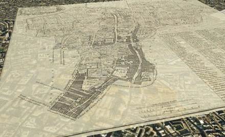
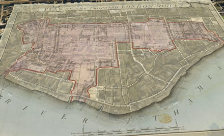
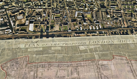
From the British Library website you can also download overlays of some of the maps as layers for Google Earth. But it would be great if there was some kind of time dimension capability to Google Earth, so that you could zoom backwards and forth in time as well as space. This is something that Dan Hill at the wonderful City of Sound has been banging on for a while, with particular reference to Barcelona.